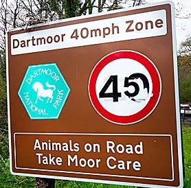
Take Moor Care!
Ignoring the weird numerical editing, who doesn't love a good pun. This one is often seen on Dartmoor, and will now remind me that I need to show the place a bit moor care...
Happy new year! This year after Christmas at acceptably small family gatherings, Lorna and I had new year with the dogs in a shed (converted for Air B&B purposes) near Horrabridge, on the south western corner of Dartmoor. While we were there I decided I'd fit in a long run.
Living as we currently do in Cornwall we don't really see much cold weather. I haven't run in long legs since we moved here and short sleeves had been the best choice for most of December. Not like the good old multi-layer days in the frozen north!
Having not done a proper long run for months and having a bit of a cold, my initial plan to try to full Dartmoor 500s (100km, 3400m ascent) seemed a bit foolish so I decided on a revised plan: I'd run in from our accomodation to the south west corner of the 500s, then run via its Tors up the northern end of the moor, back south, but then miss off the section to the east and head back across to Horrabridge. It should be about 85km. I also decided to stick in the five Dartmoor 600s, some of which for reasons unknown to me are not included in the 500s (?!).
 |
| 500s in red, my plan in blue |
The weather forecast looked a bit grim but going on Sunday was my only option, so I packed my stuff and set the alarm for 5. A decent long day out would do me good! My food was a fine-looking collection of leftover Christmas cake, chocolates, sandwiches made with incredibly dense Rye bread, and two pots of rice pudding.
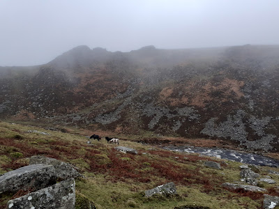
I plodded out through Sampford Spiney and up to join the 500s route at North Hessary Tor. It was a bit foggy but I was concerned I couldn't see the light on the mast, then suddenly it appeared very close in front of me - it was obviously foggier than I had realised! The route up the west of the 500s route (the opposite direction to most 500s runners, I think) was fairly straightforward navigationally, but tough going underfoot with long sections of following bearings over tussocks over Great Mis, Little Mis, Cocks, Lynch, Chat, Great Links, Gren, Hunt, Kitty and Steng-a-Tor. It was grey and drizzly, and the wind was building, but I didn't feel cold and enjoyed the brief outbreaks of sunshine. I sent Lorna a text on the short track section before the climb up to High Whillays and Yes Tor (the first two 600s) telling her I thought the sun had made a decisive move...
I got to the top of Yes Tor at pretty much bang on 6 hours and 40km. So far I had been to all the tops on the 500s route, but I now wondered about dropping Cosdon Beacon, which would've been the most northerly point. I felt bad as I always think of this as Charlie's hill (he lived at the bottom of it) but from the south it looked like a faff to get to, so I did West Mill Tor, East Mill Tor, Oke Tor and headed south.
7 and a half hours in I was at the top of Hangingstone hill (third 600). My prediction of the victory of sun over rain had been optimistic. Up here it was getting a bit grim. The wind had picked up and I was now soaked in driving rain. With slow going over tussocks I was getting cold. I now had gloves on for the first time in a long while, but my fingers were too stiff to get them fully on, which was a bit of a concern as it meant I was struggling to open food. It all felt a bit too close to the limit, so I decided it was time for decisive action. I checked the map and saw the vague possibility of an escape route via lower ground to the east and Postbridge, then maybe the road to Princetown and home.
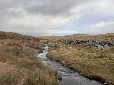
Stream and river crossings had been hard work all day. It took me ages to find a place to cross the Tavy earlier in the day, and even the smallest streams on the map were now torrents requiring wading with water up to my winkie. The North Teign river below Fernworthy forest was just impossible to cross. It had risen outside its normal channel meaning that after wading through a knee-deep section I would then reach the proper channel and go in to my waist. After a couple of these I realised this way was not sensible. I was out of the wind and slightly less uncomfortable, but the only way home was going to be back up on the tops.
I went back up via Quintins Man then followed the range posts down to Flat Tor, Rough Tor and eventually the Beardown Tors and finally into Two Bridges. I was still chilly on the road to Princetown but I was slowly warming up. From Princetown I followed a track around an old quarry then back over towards Horrabridge. By now the fog had cleared and the rain had stopped down here, so it was actually quite pleasant. I tried a bit harder towards the end to see if I could scrape a sub-12 hour finish and was rewarded with 12:03. But nevermind, there was cheese and beer at home.
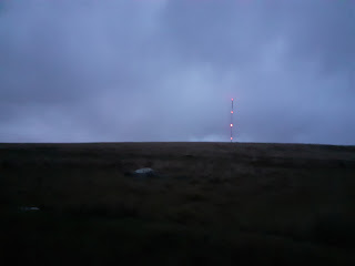 |
| North Hessery from the way back in |
This wouldn't normally be a run worthy of a blog, but I'm writing this as a reminder to myself that Dartmoor, although in the soft and warm south, does deserve some respect. I need to remember to put on gloves a bit earlier, and to pay a bit more attention to those wiggle blue lines across the map.
Strava - https://www.strava.com/activities/6463061308


Comments
Post a Comment